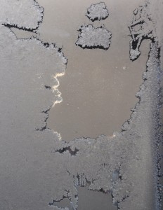
Any idea where and when this shot was taken?

This entry was posted
on Sunday, January 12th, 2014 at 5:43 pm and is filed under Uncategorized.
You can follow any responses to this entry through the RSS 2.0 feed.
You can leave a response, or trackback from your own site.
Wow! Is this ice on a window during the Polar Vortex? Such an interesting shot!
Ellen – how did you get NASA to allow you to shoot from the International Space Station? Google Earth says it could be south of Athens, between the Gulf of Corinth and the Aegean Sea!
From the outside looking into the front window of your car during the big freeze last week? Waiting for signs of life from your defroster?
It looks like a map of the Antarctic, Hudson Bay during a deep freeze, or a bacterial culture from one of my classes at Bronx Science. Seriously weird but understandable after last week’s sub-zero weather.
I’m going with frost on glass.
Interesting shapes and monochromatic color scheme. I’m going to go with frost on the glass, too.
What an interesting shot! I am particularly taken by the way the light is coming in from behind the frost. It makes it very three-dimensional.
Yes, it was frost on the window during the Polar Vortex, or as we used to call it, cold winter day. I just thought it was so fascinating. It looked like a relief map of the earth from space. I loved the play of light and dark around the “continents”. Thanks, as always, for all of your comments.
I love this. It’s beautiful when looking very closely at something small can give the feeling of being far away and looking at something larger…
Beautiful! Reminds me of Daniel Zeller’s drawings of microscopic organisms. Almost looks like a frosty map.